Many companies are introducing special measures to help people combat the ongoing COVID-19 crisis. Recently, Uber launched its UberMedic Service to help healthcare officials and the Government of India launched the AarogyaSetu mobile app earlier today. On similar lines, Google Maps now has released the COVID-19 Community Mobility Reports to help healthcare officials as they make critical decisions during this time.
Google Maps’ Community Mobility Reports for COVID-19 will provide insights about the places prior to the lockdown and what has changed now as people are working from home, shelter, and other policies. All these are aimed at flattening the curve of COVID-19 and Google says that stringent privacy policies and protocols are followed while developing these reports.
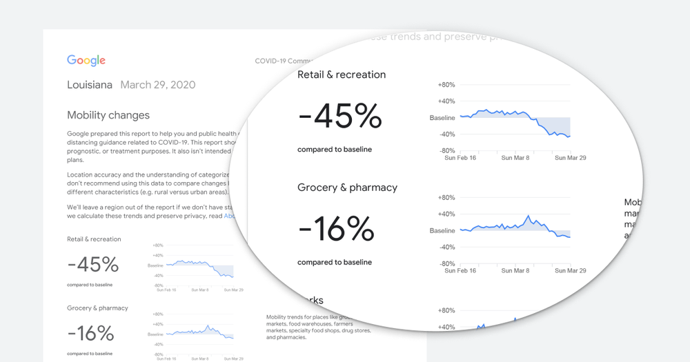
The reports include the most recent information, trends over several weeks across places like residential, groceries, pharmacies, parks, retail, parks, recreation, workplaces, and transit stations. These are aggregated, anonymized data and will show a percentage point increase or decrease in visits and not the absolute number of visits.
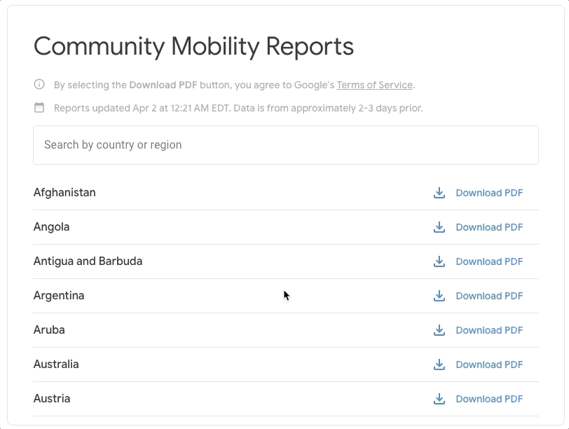
Keeping the user’s privacy in mind, Google will not be sharing contacts, an individual’s location or movement. Google hopes these reports will aid public healthcare officials’ decisions about how to manage the COVID-19 pandemic. The Community Mobility Reports will cover 131 countries and regions initially more countries and regions will be added in the coming weeks.