Using data from local collaborators Tech Mahindra and Mumbai-based Genesis International, Google has unveiled its interactive 360-degree panorama feature for 10 Indian cities. The firm claims that it will enable a more reliable, accurate, and visual mapping experience for its users, solving local challenges for communities at scale and also facilitating a more sustainable environment for future generations. Google Maps was recently updated with Immersive View, Live View in third-party apps, and pricing for toll roads in India.
Maps Street View experience
Starting today, Street View will be accessible on Google Maps in India with brand-new imagery that we have licensed from our regional partners, renowned tech firms Genesys International and Tech Mahindra.
- At the start it will be available in Bengaluru, Chennai, Delhi, Mumbai, Hyderabad, Pune, Nashik, Vadodara, Ahmednagar, and Amritsar covering more than 150,000 kilometres.
- By the end of 2022, Google hopes to have this implemented in more than 50 cities thanks to these relationships.
For communities at scale
To assist India in improving road safety and reducing traffic congestion, Google today announced collaborations with regional traffic authorities, which democratizes knowledge and addresses problems like COVID-19 and public sanitation.

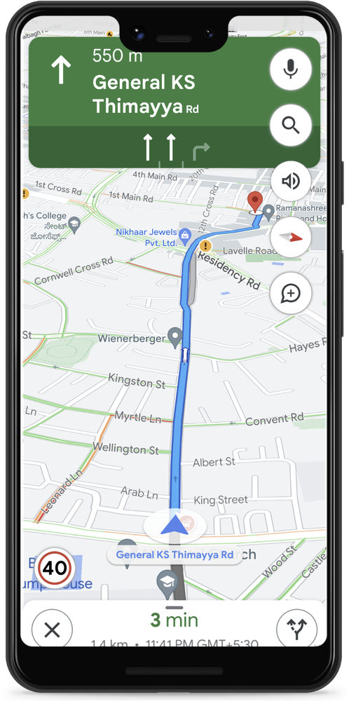
- Starting with Bengaluru and Chandigarh, traffic officials will now be able to add speed limit information to Google Maps.
- It will also display information about road closures and accidents on Google Maps in eight Indian cities, including Delhi, Hyderabad, Chandigarh, Ahmedabad, Kolkata, Gurgaon, Bangalore, and Agra. This will help people plan their trips and avoid crowded areas.
Google Environmental Insights Explorer
A tool to help cities measure emissions and identify reduction methods. Four Indian cities, Bengaluru, Chennai, Pune, and Aurangabad, are using EIE transport emissions information to generate Climate Action Plans.

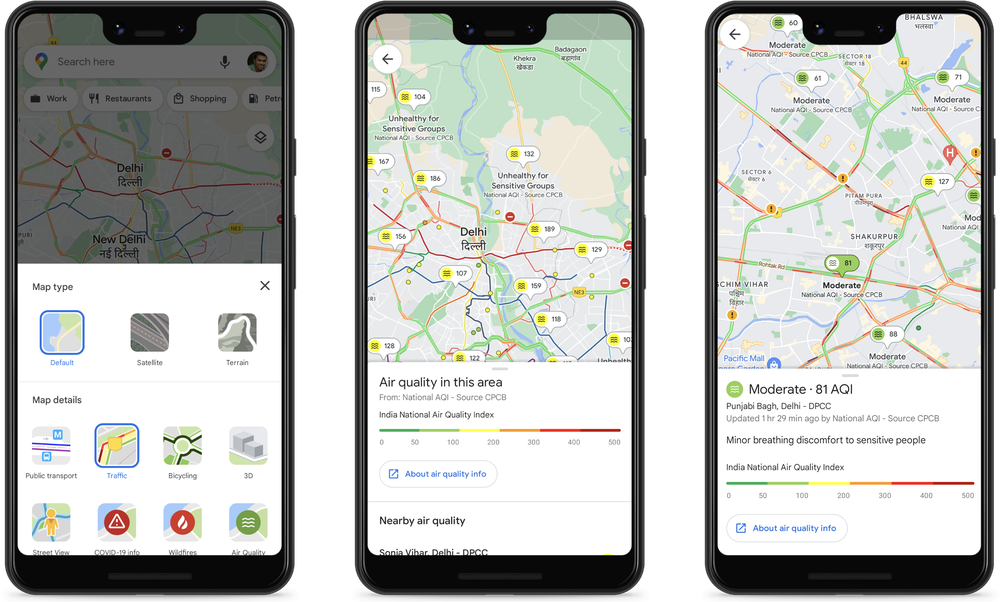
Additionally, Google and the Central Pollution Control Board have worked together to make reliable air quality data accessible on Google Maps. Users can access this information overlay by choosing “Air Quality” from the menu that comes up when they touch the “Layers” button in the top right corner.
Commenting on the launch, Miriam Daniel, VP, Google Maps Experiences, said:
India’s digital adoption continues to move at a phenomenal pace, and we remain focused on accurately modeling, reflecting, and solving for today’s rapidly-evolving India. Needless to say, it’s been an exciting near decade and a half for Google Maps in India – and our work is far from done.
These announcements underscore our commitment to extending our technology and expertise to local partners, to deliver even more useful information on Maps, and doing this responsibly by ensuring that Google Maps continues to deliver the most accurate and trusted information.
