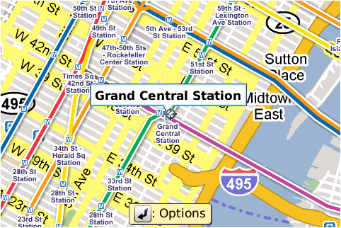
The Google Maps team always does some interesting work. The latest addition to GoogleMaps Mobile is Layer for the NYC Subway . If you are in a city which has a underground or any railway system, you are always forced to carry a map of the trains always so that you never get lost. When in London I was always carrying the TubeMap . It’s humanly impossible to memorize the network of trains and routes especially when you are a first timer in a new location. But what I found interesting is that even locals use the maps so much to get from one place to another. Now NewYorkers using the SubWay can celebrate .Google has added a layer for the NYC subway routes on a map to help you navigate the New York City subway system. To see this new layer while viewing a map of New York City, just click the Layers menu and then turn on the Transit Lines layer. To download new version of maps just hit m.google.com/maps from your mobile.
Warning : Most underground train systems don’t have network coverage and Google maps might need a working data connection to download data. So make sure you use the app to plan your trip when you have a signal !
